
Driving to the Arctic Circle is one of Canada’s great adventures (and road trips)! Carol Patterson walks us through what you need to do to prepare for the trip, and where to stop along the way.

My hands grasped the steering wheel so tightly my knuckles turned white. The road was a twisting, gnarly swirl of mud. I hoped my early years of driving through Saskatchewan blizzards would stand me in good stead, and I would finish my trip on Canada’s first highway to the Arctic Ocean without needing a tow truck.
I first drove the Inuvik to Tuktoyaktuk Highway (ITH) months after it opened in November 2017, an engineering marvel that saw a modern road perched atop permafrost. The 138-kilometer highway took four years to build, used 1,000 person years of employment, and cost approximately $300 million, one of the most expensive roads in the country.
Many people like to combine the trip along the ITH with a warm-up on the Dempster Highway, a 740-kilometre gravel road that starts a few kilometres east of Dawson City. Driving north from Dawson City to Tuktoyatkuk isn’t for the faint of hearts or small vehicles, but if you’re willing to take on an epic road trip, this is a journey like no other.
A Little Road History

Building a road to the Arctic Ocean was a government priority as far back as the 1960s. Tuktoyaktuk (aka Tuk), an Inuvialuit community of approximately 965 people, could only be reached by air, sea, or in winter, by ice road. Having a year-round road would reduce the cost of living for residents, and increase tourism.
The route was surveyed in 1974, then several decades passed as land claim agreements were signed, environmental assessment studies conducted, and a cost-benefit analysis was done. In 2013 construction started.
The highway is routed across permafrost – a layer under the ground that is permanently frozen. If it stays frozen, structures built on permafrost are stable, but if the permafrost melts, structures shift or in extreme cases, are absorbed into the ground.
The Dempster Highway built decades earlier blasted through permafrost, the newer ITH was placed on the land. To avoid heating the permafrost and destabilizing the road base, engineers placed a geotextile fabric between the ground and a bed of gravel two metres thick.
Driving the Inuvik to Tuktoyaktuk Highway (ITH)


As I slid across a muddy corner of the ITH, several motorcyclists, up to their ankles in mud, pushed their bikes out of the way. I would hear later that a flatbed truck had been sent from Inuvik to rescue the stuck equipment. This is a road that’s best to drive on sunny days.
I had rented a large SUV and I needed the power and weight to get through the muddiest spots. If you’re making the drive, plan to rent or bring a large SUV or truck. The flat tundra was a visual potpourri of golds and greens but there were no pullouts or rest areas to stop. A quick pause in the middle of the road for photos was the only break I got.
It takes about three hours to drive the road in good conditions but you need to bring water, food, and a satellite phone in case of emergencies. A good spare tire is also recommended.
As I approached Tuk, I saw a large rounded hill in the distance. It was a pingo – an ice-cored hill unique to the north. This one is the centerpiece of Pingo Canadian Landmark, a 16 km² Parks Canada site with eight of the 1,350 pingos in the region.

The End of the Road
I’d been to Tuk in 1982 as an accountant when oil and gas development was booming. Now, oil and gas activity are much reduced, and as I drove into Tuk, the town seemed balanced between ancient traditions and modern ways.
The work camp I’d once stayed in was boarded up. Snowmobiles sat next to children’s plastic toys in the side yards of houses nestled along the Beaufort Sea; many people here hunt and fish to supplement processed food from the “south”. With a bad weather forecast, I popped into the town office for a certificate saying I’d completed the drive, and stopped at the Northern Store for snacks for the drive back.
Changing Fortunes
When the road opened, people had high hopes for tourism. Five years on, this potential is bearing fruit. According to a representative with Northwest Territories Tourism, three new bed and breakfasts have opened, and the campground hosted almost 29,000 campers in 2022.
Local businesses are noticing an increase in visitors and with funding assistance to weather the pandemic, tourism operators are ready to welcome adventurers wishing to complete the ultimate road trip and reach the Arctic Ocean.
Adding the Dempster Highway to Your Trip

If you’re headed this far north, it makes sense extend your trip, and long before the ITH opened, the Dempster Highway held mythical status among road trippers.
Starting just east of Dawson City, the rugged drive passes through the two mountain ranges (Ogilvie and Richardson), the continental divide (three times), the Arctic Circle, and across the Mackenzie and Peel Rivers (by ferry in summer) before reaching Inuvik and the start of the ITH.
Annie-Claude Dupois, Acting Global Marketing Manager for Travel Yukon, confirms that travelers have been adding both roadways to their vacation plans.
“There’s been an increase (in visitation) at Tombstone Territorial Park and Inuvik because they want to make it all the way to the Arctic Circle. It (the route from Dawson City to Tuktoyaktuk) got very popular,” Dupois says.
What to Know About Driving the Dempster Highway
The Dempster Highway is well-maintained and in good weather can be driven in two days one-way, although you should add time if you like to explore or you’re travelling in shoulder seasons. Bad weather has stranded people on the highway for hours or even days so check forecasts before heading out and carry extra supplies and equipment.
Also be aware the highway is closed for several weeks in late fall and early spring when the rivers are freezing and thawing and ferries don’t run.
Make overnight reservations as early as possible at the 32-room Eagle Plains Hotel. It’s located at the mid-way point and has the only gas station until you reach Fort McPherson or Inuvik.

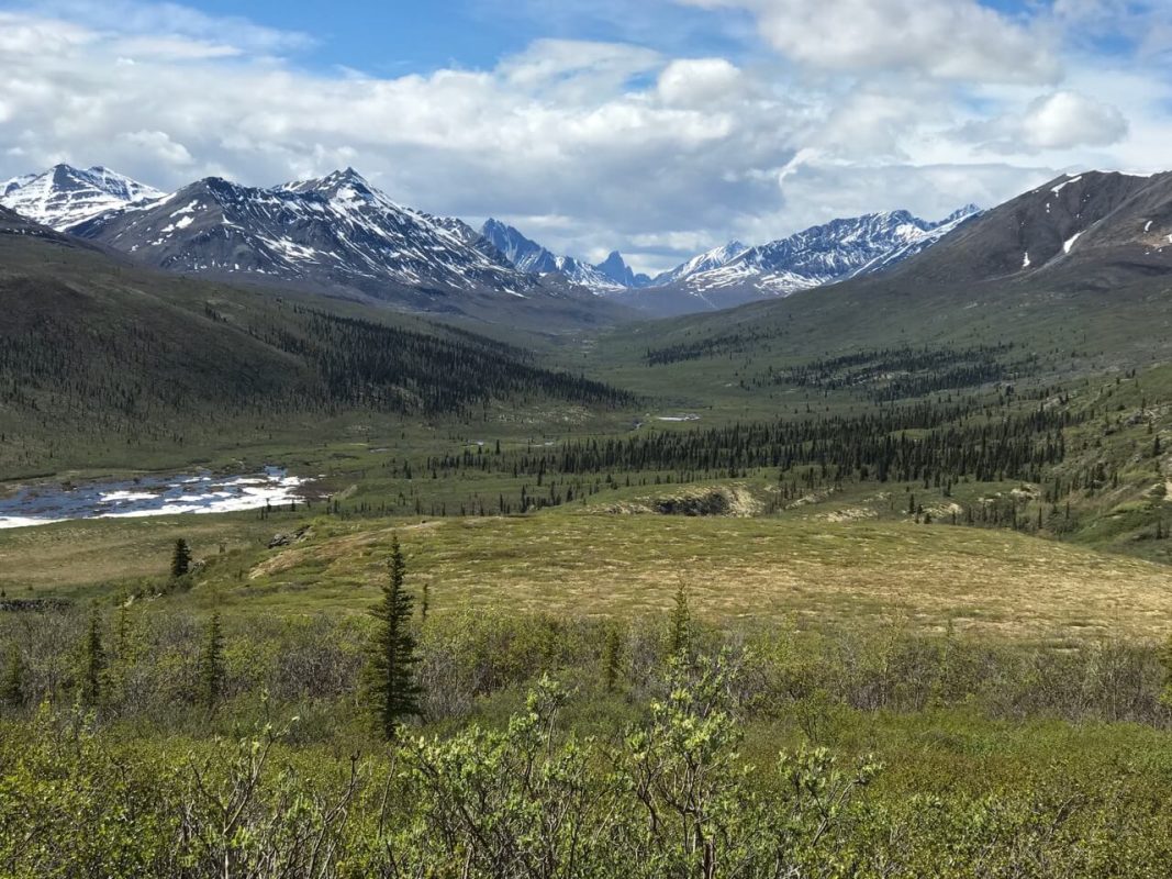
Other popular stops along the Dempster include Tombstone Territorial Park, the Arctic Circle marker, the Teetl’it Gwich’in community at Fort McPherson and its busy Tent and Canvas Shop, and Inuvik’s Western Arctic Visitor Centre.
If you have proof that you dipped your toes in to the Arctic Ocean (take a photo when you reach the end of the ITH) you can get a certificate from the staff at the visitor centre. They can also give you an Arctic Crossing Certificate.
Whether you end up tackling the ITH, the Dempster Highway, or both, you’re in for one of the most memorable road trips of your life.

Carol Patterson is a Fellow of the Royal Canadian Geographical Society and an award-winning journalist seeking out North America’s best wildlife viewing experiences. You’ll often find her and her camera following the seasons and the birds that come with them. She’s been a pilot, an accountant, a university professor, and an avian tourism consultant, but says her best gig is writing stories for curious travelers.